
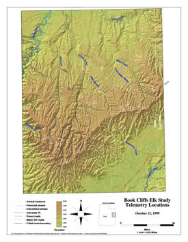
 and/or inaccessible study areas. Aerial surveys are often the only way to observe
the surrounding habitat and get a handle on cumulative impacts, surrounding
critical habitat, seasonal ranges and migration corridors. Aerial surveys are
also the only way to determine population density and habitat use at any given
time for wide ranging species.
and/or inaccessible study areas. Aerial surveys are often the only way to observe
the surrounding habitat and get a handle on cumulative impacts, surrounding
critical habitat, seasonal ranges and migration corridors. Aerial surveys are
also the only way to determine population density and habitat use at any given
time for wide ranging species.
InterWest Wildlife has extensive experience conducting aerial surveys. We have conducted aerial surveys for waterfowl and shorebird populations over and adjacent to the Great Salt Lake. We often conduct raptor surveys from the air to locate nest sites. InterWest Wildlife has also conducted aerial surveys for big game, threatened, endangered, and sensitive species and their habitat.